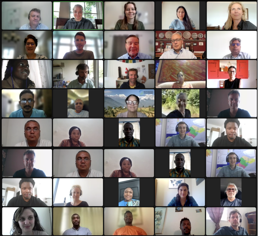
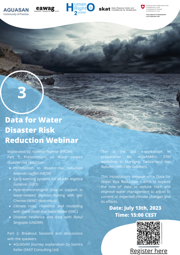
The Data for Water-Related Disaster Risk Reduction workshop was held on 13th July via zoom. It attracted around 60 participants from all regions of the world. This interactive event was the third and last of the AGUASAN Workshop e-learning journey, in preparation for the full-week workshop in Martigny this October.
The informative session, introduced by Amanda Loeffen (HR2W), included presentations from speakers from organizations that are working with digital technology in the water sector, including Angelica Gutierrez (GEO GLOWS), Igor Chernov (World Metereological Organisation), David Baxter and David Dodd (International Sustainable Resilience Center), and Rahul Sengupta (UNDRR). The webinar aimed to give examples of tools that can process data to help water management and society’s preparedness and resilience when facing disasters.
“We are aiming for resilience” says Amanda Loeffen “we want natural or built systems to have the ability to recover from an extreme event”.
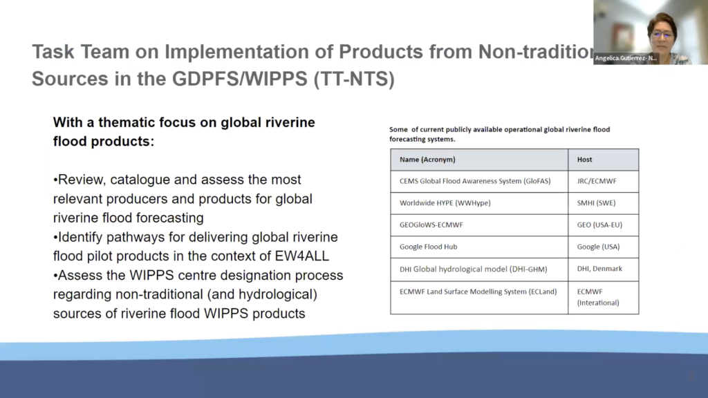
Angelica Gutierrez is a lead scientist at NOAA and co-leads the GEO GLOWS initiative. She presented several initiatives such as the Early Warnings for All, launched in November 2022 by the Secretary General of the UN. This system aims to have every person in the world protected by early warning systems by 2027. One area of focus is preparedness and response. The task force is working on the implementation of products from non-traditional sources in the WIPPS (WGS 84 & ITRF Precise Positioning Service) an online service that implements Precise Point Positioning (PPP) methods to produce very precise absolute position estimates, given several hours of GPS observation data. It includes a catalogue to assess relevant producers and products for global riverine flood forecasting (Fig. 2).
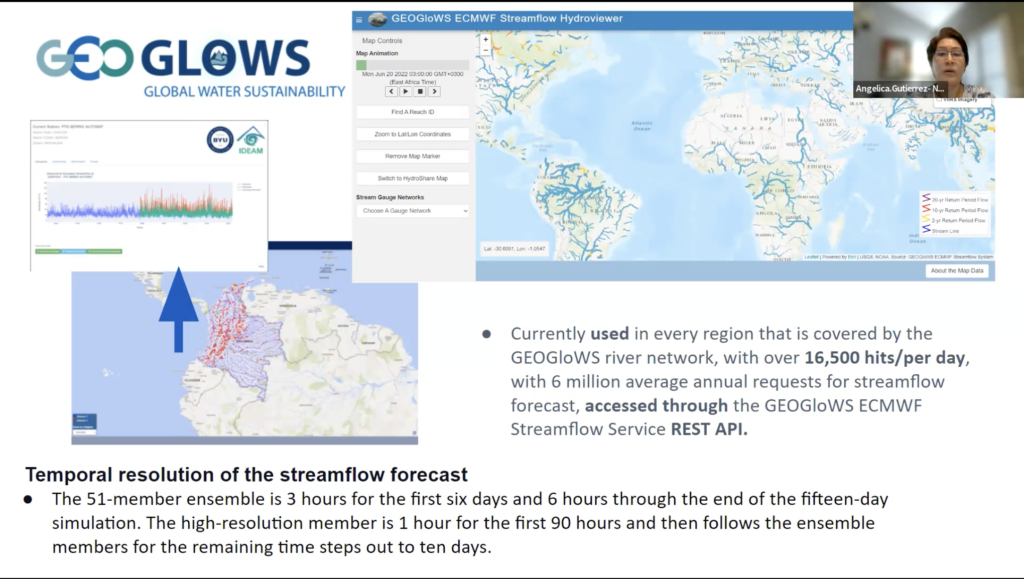
GEO GLOWS, is a global initiative that forecasts flows in every river in the world and a retrospective analysis. It uses satellite data, corrected by more than 12,000 in-situ stations on the ground.
GEOGloWS helps to organize the international community engaged in the hydrologic sciences, observations, and their application to forecasting and provides a forum for government-to-government collaboration, and engagement with the academic and private sectors to achieve the delivery of actionable water information. Since the formal creation of the initiative in 2017, the most significant element of GEOGloWS has been the application of Earth Observations (EO) to create a system that forecasts flow on every river of the world while also providing a 40-year simulated historical flow.
“Available data often remains disperse and difficult to discover, access and reuse” – Igor Chernov
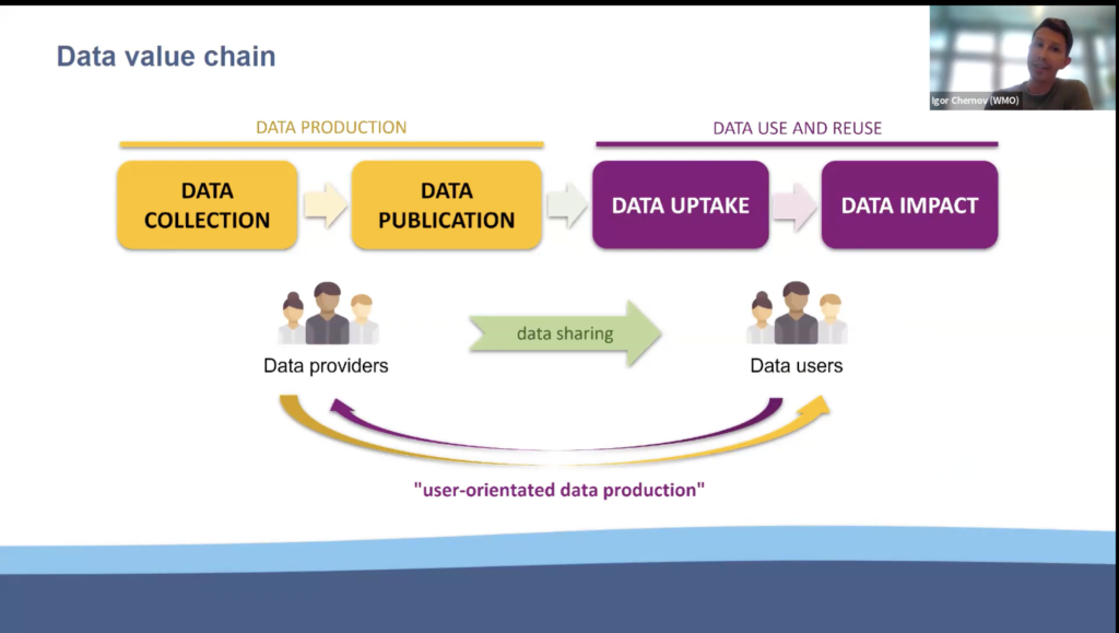
Igor Chernov, an environmental scientist professional at WMO and the Hydro Hub project officer, introduced the interconnected nature of freshwater systems and how it is important to have data available from different stakeholders and countries. Critical water-related activities that rely on hydrological data include applications such as managing water rights, transboundary water issues, monitoring and maintaining environmental flows.
WMO established the Hydrological Observing System (WHOS) to help countries and institutions to advance the inter-availability and inter-operability of hydrological data and for it to be FAIR (Findable, Accessible, Interoperable, and Reusable).
The resilience work at International Sustainable Resilience Center (ISRC) was introduced by David Dodd, the CEO and David Baxter, a Senior PPP Advisor. Their tool builds impact scenarios under varying hydrological events that can be used to estimate the potential risk for flooding and both the physical and societal costs. It has a direct use in terms of insurance cost, and provides a systematic method for investment decision-making to reduce risk.
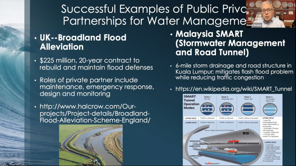
David Baxter complemented this introduction with some case studies in the UK and Malaysia where this type of technology has been used to design flood defense mechanisms and innovative mitigation and use of tunnels in flash floods (Fig. 5)
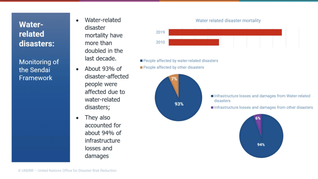
Rahul Sengupta is a programme management officer at the UN office for Disaster Risk Reduction UNDRR). He explained the SENDAI Framework and their findings. It is striking to note that 93% of disasters that affected-people are water-related (Fig.6), and that mortality has doubled in the last decade.
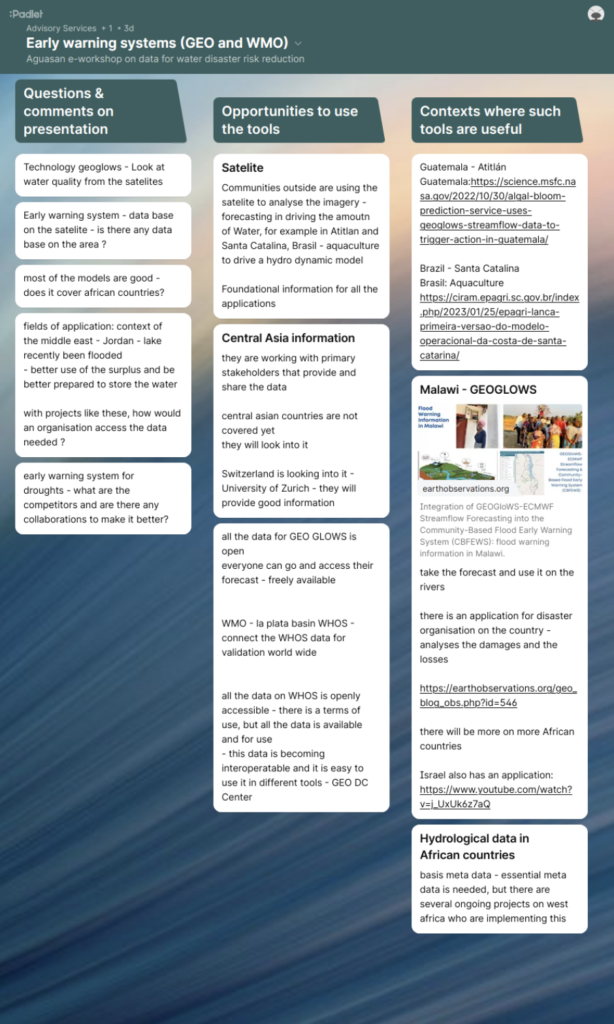
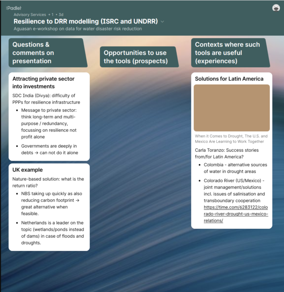
The presentations were followed by interactive breakout groups to allow people to ask more detailed questions from the presenters, and to explore ideas for opportunities and contexts for these tools. The padlet boards are shared below (Figs. 8 and 9).
After the review, Samira Keller from SKAT finished the session with an overview of teh AGUASAN programme, and some information about the full-week workshop in Switzerland this October (more information will be released about this shortly).